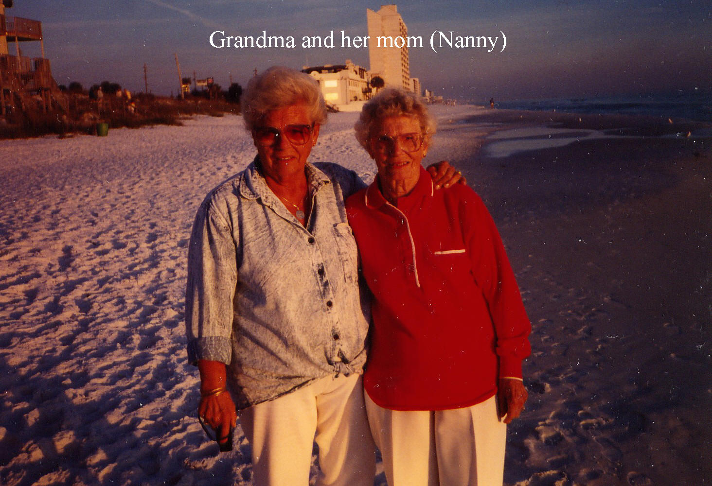
Thursday, July 26, 2012

BAXTER & ACADIA HIKING & CYCLING ADVENTURE in Maine of July 2012


A WEEK HIKING IN MAINE, July 14-22, 2012
It was a long-awaited hiking extravaganza with a little bit of kayaking and cycling to the mix.  The weather couldn’t have been better, with heat, breeze, sun and yes a little bit of humidity so as not to get homesick.  Off we went, early Saturday morning from Ted’s house shortly past 6:30 am.  Gord, Ted and I in one vehicle and Ted’s brother Joe with Vera and Kyla.  Our first site was fixed on Baxter State Park, where we would set up camp in the park, which was kept very rustic, outhouses and treated water.  As this was still car camping, I was afforded the luxury of an air mattress.  We made our way with a couple of stops to empty and replenish and finally at Millinocket, we sought out the grocery store for Joe’s beer and other necessities.  It would be Joe, Vera and Kyla’s first rustic camping, but somehow they managed very well with all the equipment they had to provide for a full course meal and practically a condo with their huge dome tent for 10 oops 3 people!!  Our little tents fitted neatly around their tent, making ours look like changing quarters or portable salons next to their “Taj Mahal” as christened by Vera.
My mission was to accompany Ted on a trek to Hamlin Peak in his endeavour to bag the 111s Highest  Northeast Peaks of the USA.  I excitedly made our plan to hike up the Abol Trail to the Thoreau Spring Cut Off, sidestepping Baxter peak towards Hamlin, approximately a 10.8-mile return trip originally.  However, that night when the ranger did her rounds checking in with the campers, she discouraged us from taking inexperienced hikers up the Abol Trail due to the “scree” along a part of the trail that would hinder and exhaust even the experienced hikers.  So, we decided to go up the Hunt Trail and return the same way, making a total mileage of 12.4 miles that day.  I had earlier explained to Ted that it would be anywhere between a 10 and 12 hour day but that we would have the daylight on our side and with an early start, we could potentially finish early.  Of course, when hiking with the great outdoors, one must always place Mother Nature first and abide by her direction.  In this case, thunder and lightning was a potential threat that we had to yield to.  The ranger warned us and so we set ahead with the knowledge we were given and started our hike shortly past 6:30 am the next morning.  We had a tremendous day full of surprises, wonder, camaraderie, fear and exhaustion.  However, we were prepared with GPS,map and walkie-talkie and enough snacks that we were able to split up at a junction that would enable Vera and Kyla to reach Baxter Peak and allow Ted and I to summit Hamlin and return back to camp, after a few lightning and thunder scares on the way down, making it back to camp by about 7pm.  Vera and Kyla made it into camp an hour earlier.  We kept in touch by walkie talkie, which assured both parties that we were on our way and safe.  It was an awesome hike.  We ate supper and celebrated our accomplishment.  The next day, Ted and I would head out to North Brother for our second peak in that area for the 111s.  Ted and I were on the trail for almost a mile when he had to admit that he would not make it out in a timely manner due to an injury he sustained on the hike the day before.  Unfortunately, he did not take his Advil to curb his aches and we had to turn back.  Once back at camp, he took his Advil and then realized he could  have managed it if he had  taken the pain killers prior.  However, this time afforded all of us to ready ourselves and make our way down to Bar Harbour for the next chapter of our trek, that is … hiking in Acadia National Park.
Acadia was beautiful against coastal shores of the Atlantic with the fishing boats and lobster  traps dotting the coves.  The weather continued to brighten our day with heat and sunlight. The next four days , we would explore the different trails throughout Acadia by bicycle and hiking boots.  We stayed at Smugglers Den Campground in Southeast Harbour.  I took advantage to explore the more challenging hikes with cliffs and rungs, among the former nesting grounds of the Perrigrine Falcons.  You could see the odd one soaring through.  These hikes were short, reaching the summits soon enough to afford you another hike elsewhere within the same day.  Another day we kayaked in Bar Harbour and another day I spent cycling along the carriage roads through the park with overhanging trees and also along the highways that provided a cycling path alongside.  There was also the free shuttle bus that carried six bicycles that was an excellent service to get us to our cycling destination and back to our camp. 
Finally, the last Saturday came and off we went to our next destination, Rockland, for our Lobster Ride’n Roll fundraiser cycling event.  There some of us cycled for 50 miles along the coast of Maine through the trees overhanging the country roads to a lighthouse at our halfway mark.  The route would then turn around and bring us back into Rockland to the Oceanview High School, where we would eat our lobster roll and relish in our cycling achievement.  It was a great week.
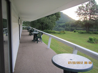
From Rockland, we drove to Rumford to stay overnight at the Blue Iris Motor Inn.  We enjoyed its back connecting deck with each unit which allowed us to pull the tables and chairs together for a final toast to a fulfilling week of adventure.  Of course, it also had a pool which three of us took advantage of.  The weather remained beautiful the next day as we made our way home to Cornwall.  One stop I would make again would be at Ile Perault’s restaurant (near Montreal) of “Smoke Meat Pete”.  It had the best smoke meat sandwiches ever which I came to learn late in life.  Oh well, Aunt Joanne and Uncle Bill, you’ll have to return so that we can take you there!
Here are some photos of our week.

Tuesday, June 26, 2012

WEEKEND AT JOHN'S BROOK LODGE


The weekend of June 22nd, we left early Friday morning for some hiking in the Great Range of the Adirondacks, New York.  Here's a weekend of hiking in the Adirondacks which brought us a medley of sun, rain, thunder and lightning.  We hiked in 3.5 miles from the Garden Parking Lot in Keene, New York, to John's Brook Lodge.  We wanted to take the South Trail but as we made our way down the steep bank over to the brook, there was so much blow down that we had to turn back and take the popular John's Brook Trail to the lodge.  We settled in at the lodge for the evening with a good supper, conversation and sleep in a bunk room of two double bunks.  The next day, Saturday, we started fresh about 7:40 am on the trail to Lower Wolf Jaw, but as we made our way to Upper Wolf Jaw, we could see the storm clouds circling on either side of the range and would make a decision atop Upper Wolf Jaw whether to continue on or not.  Several systems were moving through the mountains bringing rain, thunder and lightning.  I didn't see the lightning until we reached the last mountain, that is Gothics, which had open slabs of rock with a cable running down it, which looks like a hose.  The very last place you want to be in a thunder storm.  As I grabbed the cable, I felt like a rock climber belaying down from a cliff in speed form, anxious to reach shelter in the short artic pine before the next clap of thunder and shot of lightning.  There was more rain than lightning but shelter was more important.  We covered about 11 miles in that loop for the day, making it back to the lodge by 3:50 pm, just in time for the sun to come out in full beauty to dry things off.  Mother Nature is never boring, challenging our senses and our skills.  The new slides created from last year's Hurricane Irene were amazing.  The last slide coming down Orebed Trail off Gothics was the most spectacular.  As we descended the slide with the rain running down the slab of rock, our boots amazingly stayed gripped as we inched our way down to reach the newly constructed wooden stairs to take us lower to the existing trail below.  The real challenge was getting from the bare rock to the steps as slick and slippery mud was between and one slip on this would send us on a sliding into pointy branches and debris at the bottom of the slide about a half to full mile below.  We carefully watched our footing and made our way, key was being alert and careful placement of your feet.  It was a great day with half and half of sun and  rain.  We finished our weekend on Sunday with the hike over Big Slide, down the Brothers to the parking lot.  It was a beautiful hot sunny day and as we  made our way home we made several shopping stops to top up our hiking gear and take advantage of sales in Lake Placid.  Of course, the WalMart stop provided us with savings in groceries and supper that night with burgers topped with Vermont sharp cheddar, hmmm, what a great way to end the day ... and of course, more pictures .... take a look!

Saturday, June 16, 2012

A VIEW FOR THE SOUL!

Saturday morning at 5am the clock alarm went off and at that time, with a cool breeze coming in the window, nice soft bed sheets, comfy pillow, ahhhh another 10 minutes ... but no actually, the best time of the day is the morning, fresh, peaceful, brand new ...hop in that shower and wake up!  Lunches were already made the night before and water filled, just breakfast with a toasted egg-cheese-tomato sandwich with a hot cup of coffee, just the right fuel to get us in the car headed towards our destination, that is, Hurricane Mountain.  Sounds wilder than it is, but actually is a most pleasant hike on a soft bed of pine needles, with the occasional plank bridge as boardwalks through boggy flatlands mingled with steep pitches up rocky and rooty terrain ... to a rocky top with a 360 degree view and an old fire tower.  We could see into Vermont across the great Lake Champlain, the hazy view of Mt Mansfield and Camel's Hump, then to the south the Dix Range, Great Range, McIntyre Range, Santanonis, and others and as we turn west, McKenzie and Moose to Whiteface and Esther, the Sentinel Range with Pitchoff in the forefront and Cascade.  Looking north we saw the Jay Range with smaller mountains the Crows and the Soda Range.  Despite the billion black flies eagerly feasting on our flesh, I had to film but quickly pulled out the bug spray and to hose us down literally.  The bug spray worked and we were able to pull out our lunch and enjoy the view.  By the time we were back at the car, our tops were completely soaked with perspiration.  The scenery offered us such a variety and we were pleasantly surprised that our bites were few!

Wednesday, June 13, 2012

DOUBLE THE PLEASURE UP WHITEFACE MOUNTAIN

My friend Lorraine asked if I could get Friday off to do some hiking.  Gladly I accepted and was able to go with her.  It was a bit windy and we knew the potential of rain but only after 4pm which allowed us to hike up the south side of Whiteface Mountain which is at the north end of Lake Placid.  We parked at Connery Pond and headed in towards Whiteface Landing which brought us to the northend of Lake Placid.  There, we looked around and decided we would swim after the hike on the way back to the car.  It was a hot summery day and the path was easy.  Only nearing the summit was there lots of boulders and slides that  were tricky and needed careful footing and good hand holds.  The last 100 feet was straight up and over boudlers with views that were astounding.  Mother Nature cleared a view for us to see into Vermont and Canada, a slight haze but still excellent visibility.  We relaxed and ate our lunch at the summit and admired the natural beauty of the area, while listening to the nearby tourists who happened to come up the paved highway to the summit in a motorcycle convoy.  It started to spit rain a bit so we decided to head down but then it stopped and out came the sun in all its heat and by the time we were back at Whiteface Landing, we were ready for that swim in the cold water.  I jumped into the waves with delight and was refreshed.  The wind increased over time and the waves were quite choppy.  We knew a storm was coming but had no idea of the hail that was happening in Cornwall and along the way towards Lake Placid.  We headed home and about half way nearing Malone, we saw snow which in fact was large hail stones that melted together on people's property.  It was amazing and in Akwesasne, the road sides were covered with hail.  Yet the only storm we encountered was a short downpour as we drove through St.Regis Falls area.  Another bonus to our day was getting through customs without a lineup.  In Cornwall, we could tell from all the leaves on the ground and snow and dinted cars that powerful hail had made its way through Cornwall.  The next day, I went with other friends back to Whiterface to hike up the north end, near Wilmington, at the Reservoir with sun, heat and visibility, no storm in sight and a slight breeze at the summit.  It was a wonderful weekend of hiking, trying a new trail and the bonus of remembering an old gem.  The surprise to this day was deciding to help two others hike up Esther Mountain, adjoining Whiteface about 1.2 miles off the Whiteface trail, to help them bag another 46r peak in reaching for their goal to complete the 46rs!  They had only started yet fell in love with the mountains as I  had.  The weather was perfect and the timing even better than before.  It was a great weekend!

Sunday, June 3, 2012

TILL WE MEET AGAIN, Grace Miller


REMEMBERING LIFE with GRANDMA

Grace Miller passed away Saturday evening 7:05 pm, May 26, 2012, at the age of 90.  A mother, grandmother, great-grandmother and great-great grandmother … family was never too far away and in her last days, family was by her side.  Her long life enabled her to see many generations of family and for family to know her.  Through all the good times and difficult times, fond memories always have a way of surfacing, enabling hearts to open and allowing love to linger.  Let’s take the time to share these fond memories so that generations may have a fuller and more meaningful picture of this lady called Grace Miller.


Her beloved cat, Mr. Jeffrey, would agree that he had a purr-fect life with her ... yes, his gentle and sensitive approach would always win her over.  Well done, Mr. Jeff!


BON ECHO CAMPING on Victoria Weekend May 2012

The Victoria Weekend in May of 2012 saw us heading to Bon Echo for a few days of camping.  We gathered up our gear and headed west, picking up my sister in Kingston along the way.  It was a hot sunny weekend, perfect weather for evenings by the fire and comfortable sleeping.  The days were quite hot but it allowed us to relax at camp and venture out along scenic trails by Lake Mazinaw.  The evenings brought beautiful sunsets which allowed photographers to hang out by the "Narrows" a narrow waterway joining both Upper and Lower Mazinaw Lake.  One afternoon, we rented a canoe to paddle out along the cliffs of Mazinaw Rock to view the pictographs.  This area is a favourite destination for painters and photographers. This 1.5-kilometre sheer rock face rises 100 metres above Mazinaw Lake, one of the deepest lakes in Ontario, and features over 260 native pictographs, the largest visible collection in Canada.  Mind you, the red dye of the pictographs are fading and therefore, difficult to make out the figures.  Nevertheless, it was great to be on the water.  Lots of song birds around, especially waking us up in the morning.  One evening, we had two baby raccoons checking us out and as we approached the sound of them in the dark to figure out what was there, they  made their way up a nearby tree.  We flashed our headlamps at them and we could then make out their eyes, shape and size.  We kept our light on them which made them anxious to get  out of the area.  They started down the trees so we backed away so that they could make their escape, which they did.  We saw woodpeckers and experienced a special treat when a pileated woodpecker came flying into camp looking for food in the dead trunks of trees lying on the ground.  We also did the hike up Mazinaw Rock.  For this hike you take the little shuttle boat across the lake to the dock at the base of the cliff, the start of the hike.  From there we climbed a series of stairs leading about 1km away to the top of the cliff, Mazinaw Rock itself.  Take a look at the video of the view atop this rock.  With the weather the way it was, we didn't want it to end but at least packing the tent was a dry experience for a change.